
Scotland Weather: Two yellow weather warnings for thunderstorms issued for parts of the country

The warnings may lead to flooding and disruption
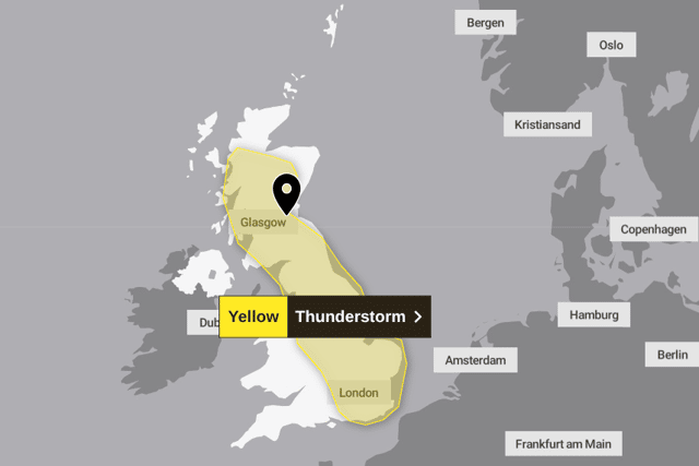
Yellow warnings for thunderstorms affecting Scotland and England have been issued by the Met Office.
The first warning began at 12pm on Sunday and lasted until 10pm, while the second comes into effect at 11am on Monday and lasts until 9pm.
It covers a huge swathe of the country, but a narrow strip of the East Lothian coast is one of the few areas set to escape the storms.
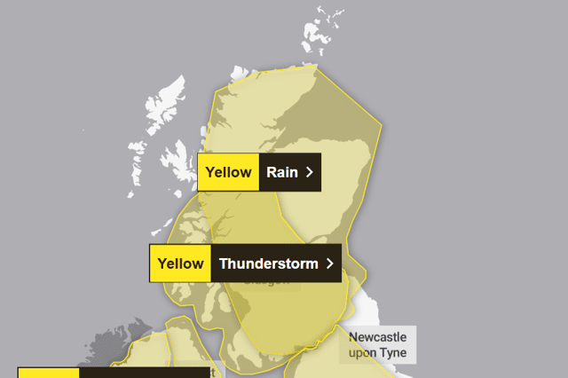

Meanwhile, for Monday, the Met Office said: “Heavy showers and thunderstorms may lead to flooding and disruption in a few places on Monday.”
This follows a 24-hour yellow warning for rain, covering Edinburgh and most of Scotland, in force from noon on Saturday until noon on Sunday. Showers and sunny intervals were forecast for Sunday afternoon, with cloud in the evening.
The Met Office yellow thunderstorms warning said: “Scattered heavy showers and thunderstorms are expected during Monday, especially during the afternoon and early evening. While many will miss the worst conditions, a few places could see 30-50 mm of rain within a couple of hours.
Make sure you keep up to date with news from across Scotland by signing up to our free newsletter here.
“Heavy downpours of rain will be the primary hazard but lightning strikes are also likely along with the potential for hail.”
It said spray and sudden flooding could lead to difficult driving conditions and some road closures.
There was a small chance that homes and businesses could be flooded quickly, with damage to some buildings from floodwater or lightning strikes. And there was a small chance that some communities become cut off by flooded roads.
“Where flooding or lightning strikes occur, there is a chance of delays and some cancellations to train and bus services
“There is a slight chance that power cuts could occur and other services to some homes and businesses could be lost There is a small chance of fast flowing or deep floodwater causing danger to life.”
Advice from the Met Office says to prepare to protect your property and people from injury.
Before gusty winds arrive, they say you should check to ensure moveable objects or temporary structures are well secured.
They added that you should give yourself the best chance of avoiding delays by checking road conditions if driving, or bus and train timetables, amending travel plans if necessary.
They added: “People cope better with power cuts when they have prepared for them in advance.
“It’s easy to do; consider gathering torches and batteries, a mobile phone power pack and other essential items.
“If you find yourself outside and hear thunder, protect yourself by finding a safe enclosed shelter (such as a car). Do not shelter under or near trees, or other structures which may be struck by lightning. If you are on an elevated area move to lower ground.”
According to the Met Office, Tuesday and Wednesday are expected to remain unsettled, but with lighter showers, before drier more settled weather arrives on Thursday, feeling less humid.
Eastern parts of Northern Ireland are covered by a 24-hour weather warning, from 6pm on Sunday until 6pm on Monday , where heavy rain is expected to cause some disruption and the possibility of flooding.
Simon Partridge , Met Office forecaster, said: "It looks like Northern Ireland is the place where we could see the most rainfall and certainly the most impactful rainfall.
"They could see 50 to 75mm of rain within 12 to 18 hours."
Comments
Want to join the conversation? Please or to comment on this article.